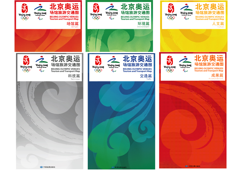
| Beijing Olympic Venues Tourism and Traffic Map is compiled and published by SinoMaps Press, with the authorization from the Organizing Committee of the 29th Olympic Games. Front side. Normally, the first-plane of the map outlines the location of the Olympic Games stadiums and gyms as well as the location of gasoline stations and public toilets in the surrounding areas of the stadiums and gyms. The second-plane of the map marks Beijing’s landmark buildings, rail transport systems and Grade 1 and Grade 2 highway networks, some flyovers and their names, entry and exit of the 5th Ring Road, and sight-seeing places and transport and tourism facilities in the surrounding area. The third-plane of the map highlights consumption-related facilities such as hotels, restaurants, banks, supermarkets and hospitals, etc. Back side. The back side of the maps corresponds with the contents of the front side of the maps in accordance with different themes and colors. This bilingual (Chinese and English) map has a total of 6 sheets, including: Sheet 1 in red color illustrates the locations of stadiums and gyms. Sheet 2 in green color illustrates the environment. Sheet 3 in yellow color illustrates humanitarian features. Sheet 4 in grey color illustrates science and technology theme. Sheet 5 in blue color illustrates transport facilities and networks. Sheet 6 in orange color illustrates achievements. Finally, there is a set combining the 6 sheets. The map uses the PP four-color printing technology, which reflects the Olympic concept of “sci-tech, green and humanitarian”. The map fully reflects the three main themes of “Green Olympics”, “Humanistic Olympics”, and “Sci-Tech Olympics” from contents collection, printing to layout-design and print format. Thus, it is of great value for collection. Language: Chinese/English |